Appalachian Trail Day 49

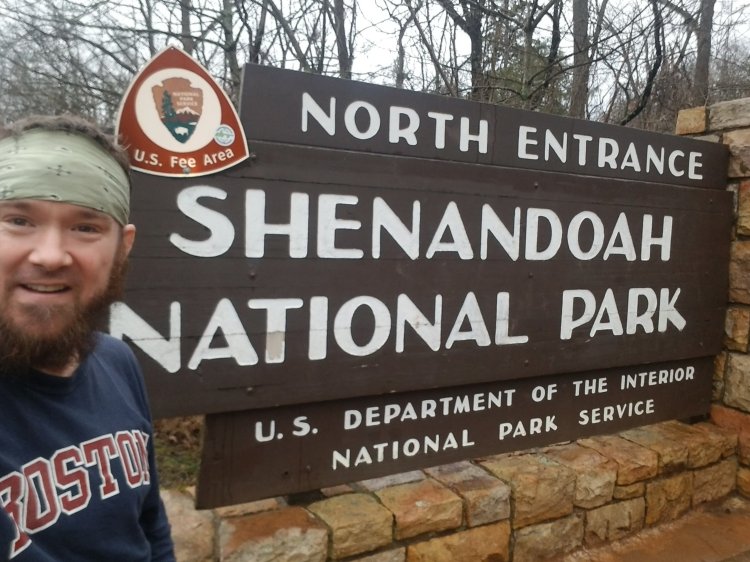
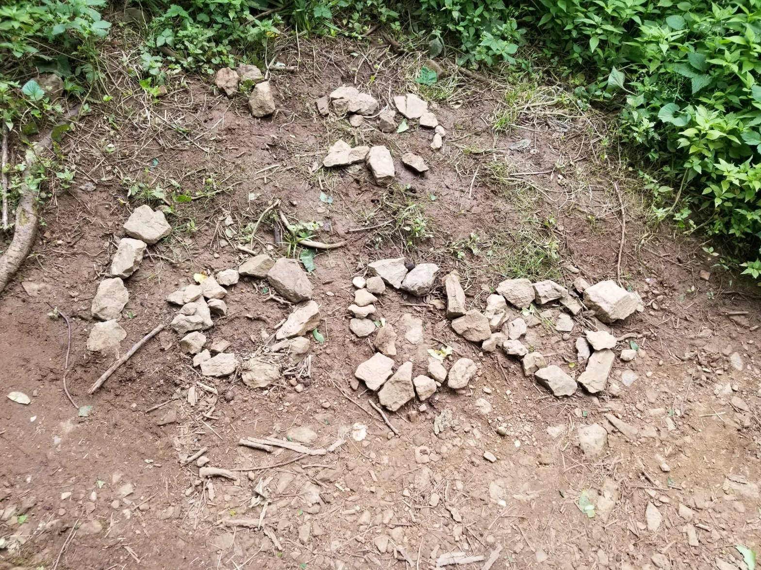
Elkwallow Wayside to Pinnacles Picnic Area – 14 miles
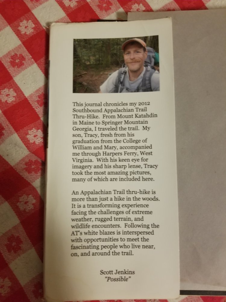
July 5th, 2020

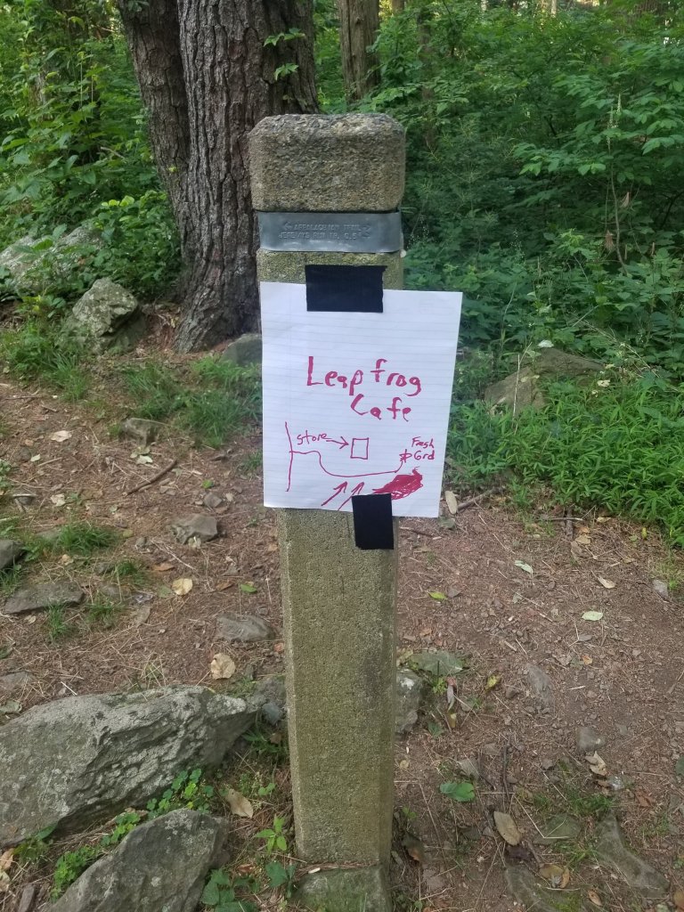
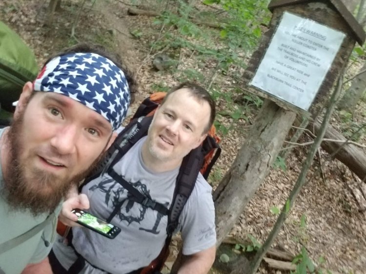
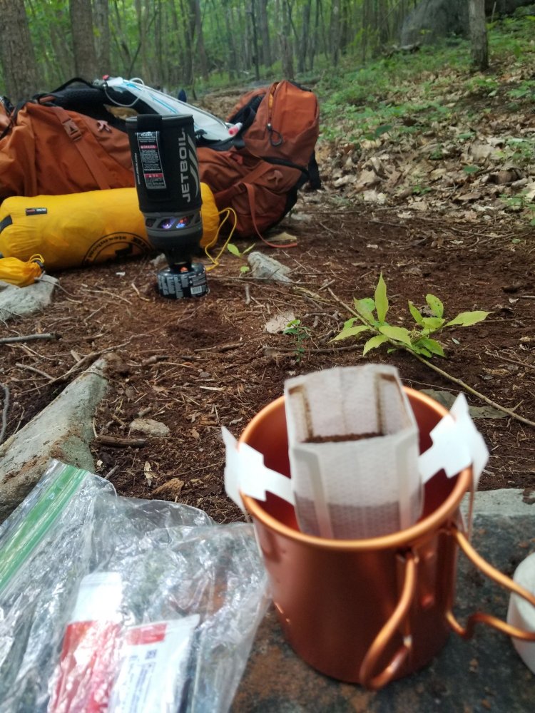
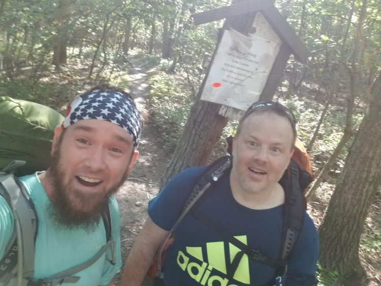
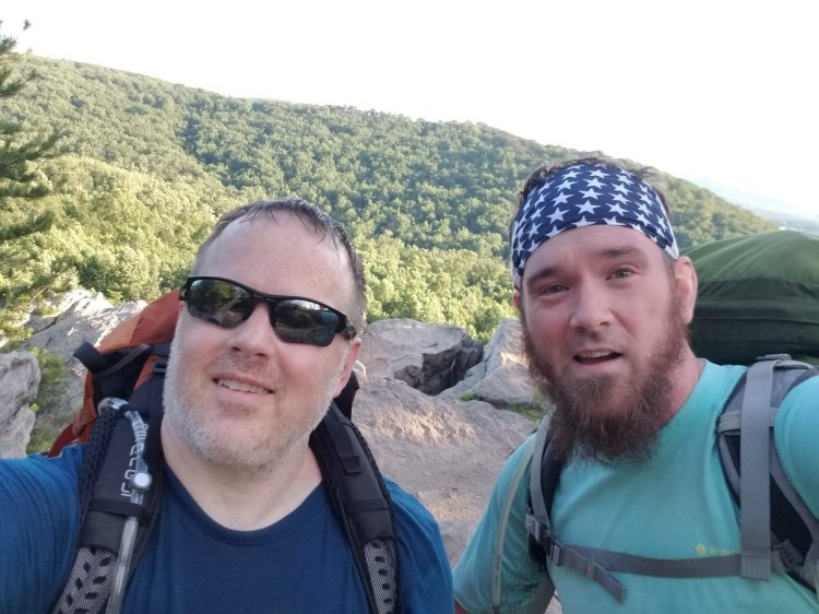
Today started great and ended horribly. I woke up excited and slightly nervous about the forecasted heat and thunderstorms although the sun was shining at the moment. I packed up and headed towards the spigot I had discovered the previous night next to the wayside. In the picnic area I encountered the legendary Fresh Grounds who operates the mobile Leapfrog Cafe. Myself and several other hikers enjoyed the most amazing breakfast… endless amounts of bacon, eggs, fresh fruit, banana pancakes, coffee, juice…definitely a huge blessing. I met Gumby and Fixit… who were heading north and preparing to do the Four State Challenge

With a full belly I was in great spirits for the first mile of my hike until I realized I’d left my phone charger in Fresh Grounds’ van. I tossed my pack and hurried back to to the wayside, thankful he was still there. By this time his cafe was overflowing with hikers, and I resisted the urge to linger and socialize.

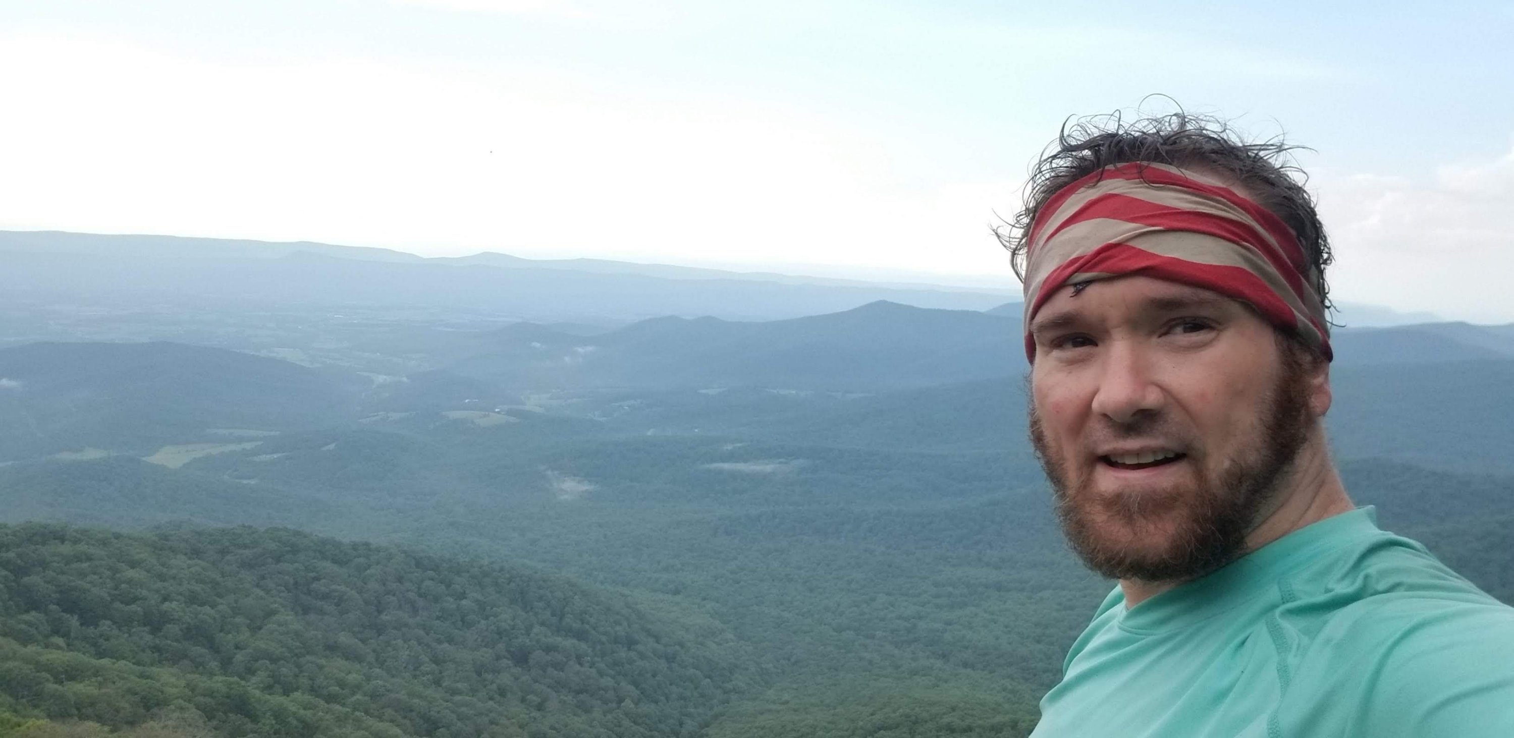
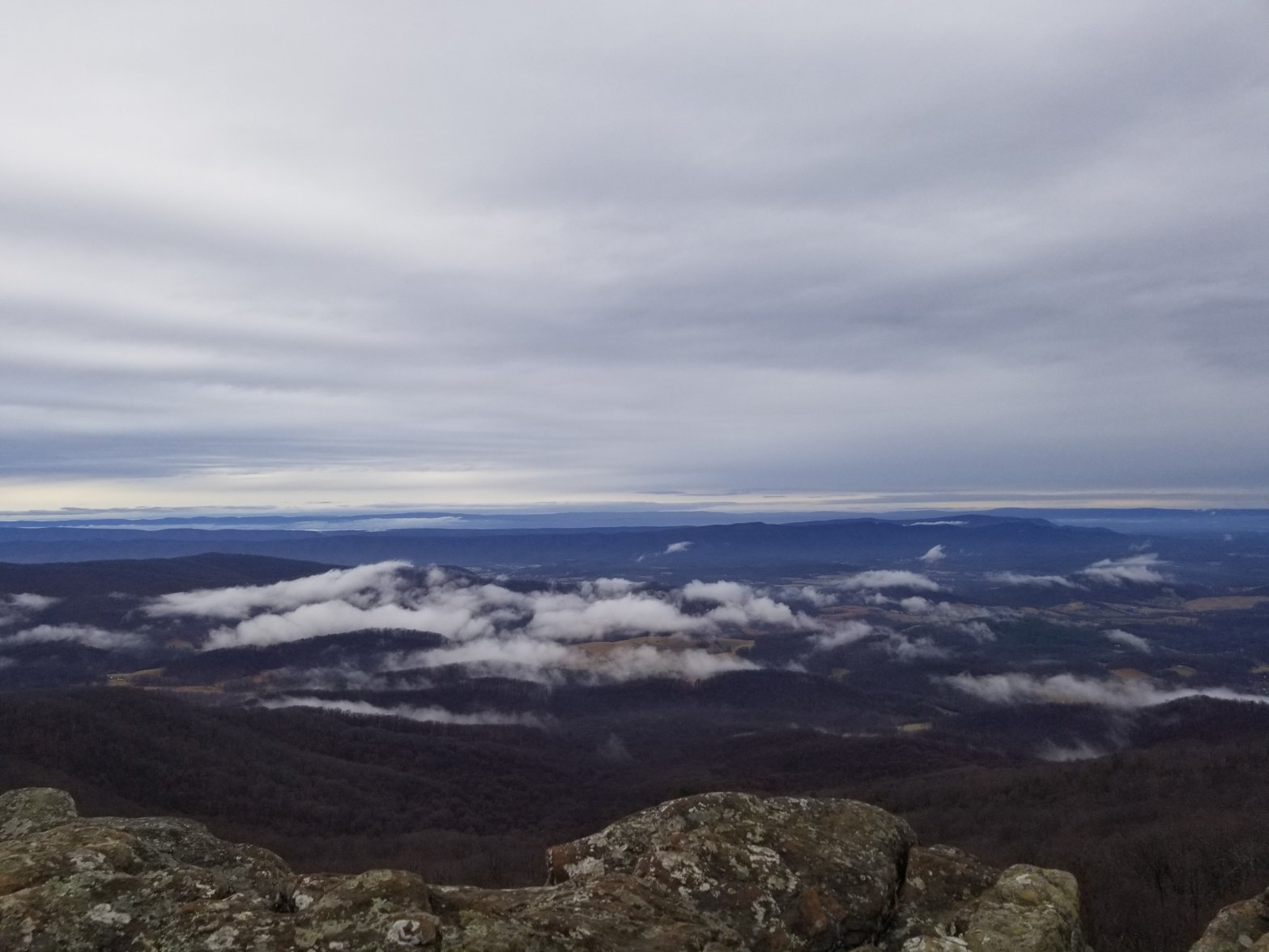
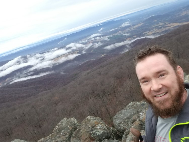
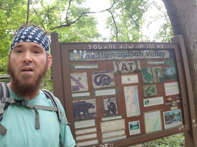
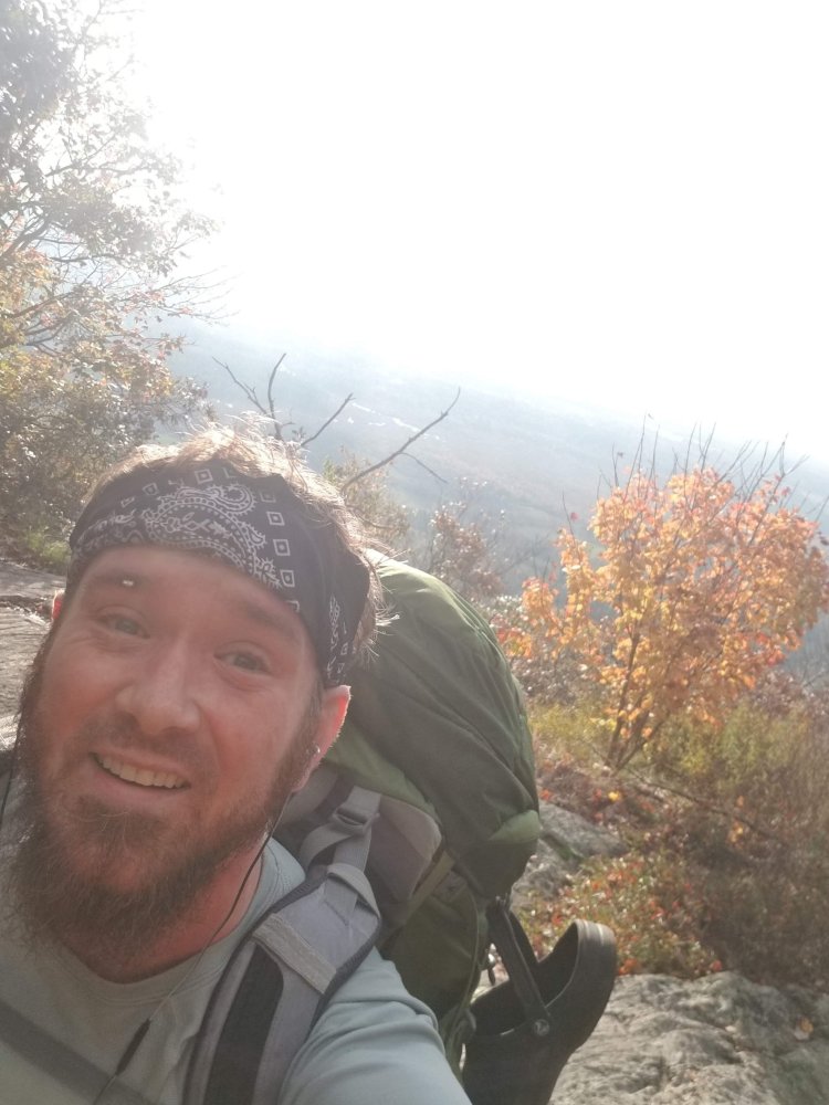
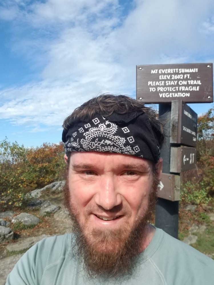
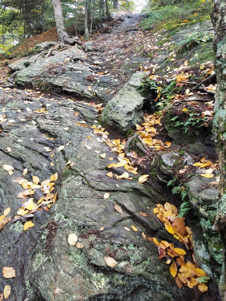
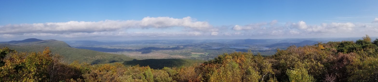
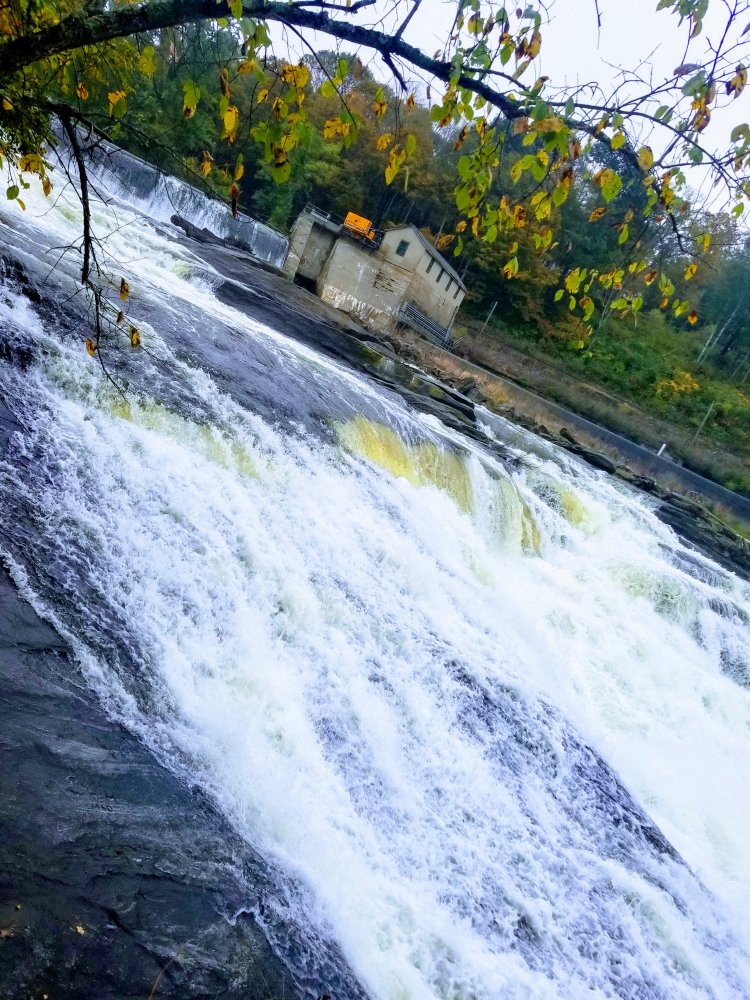
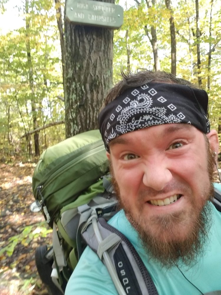
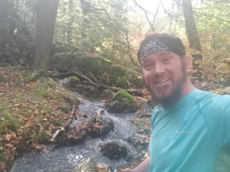
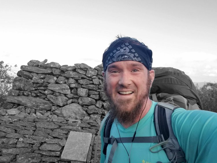
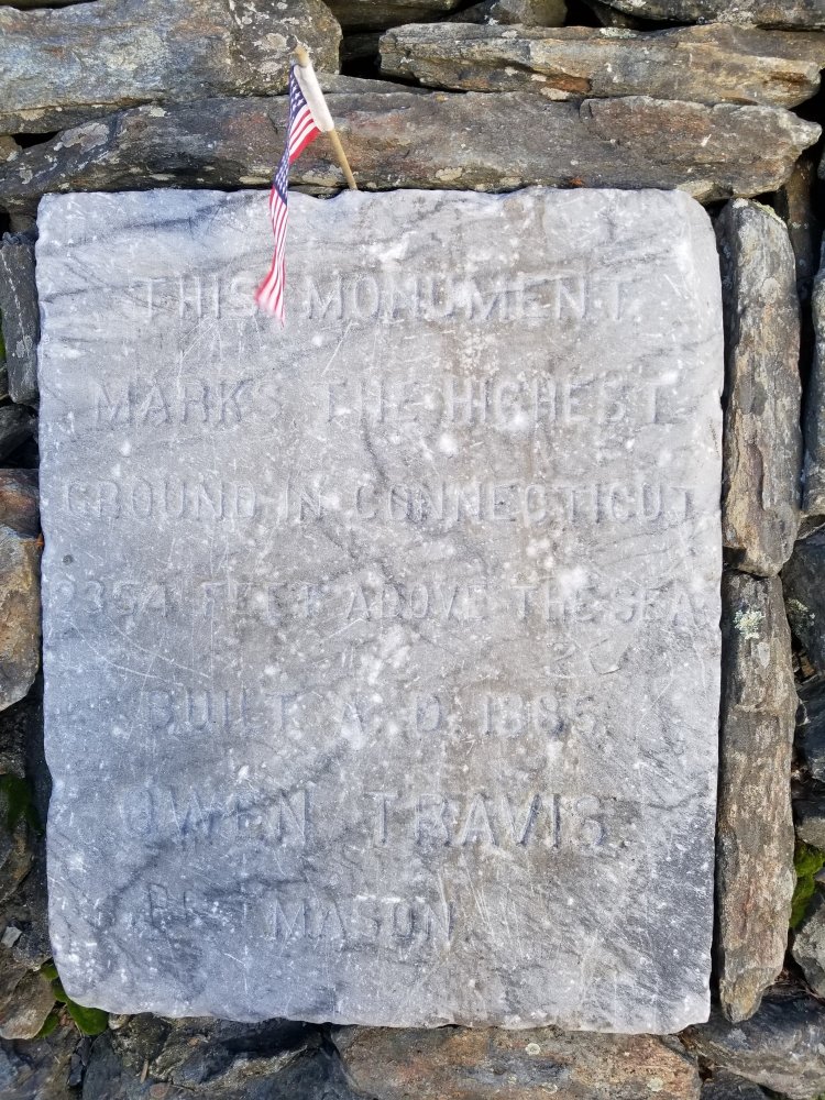
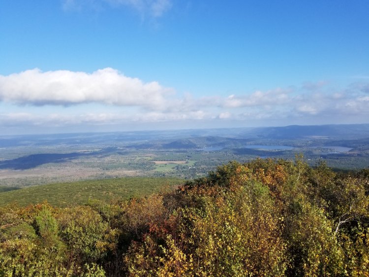
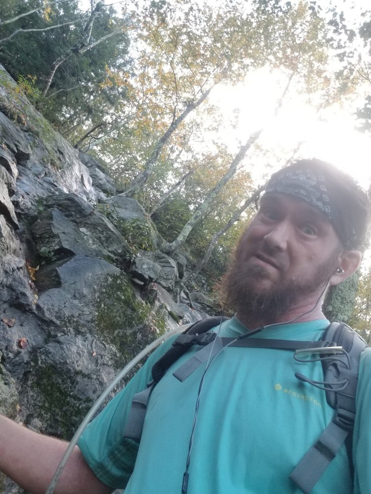
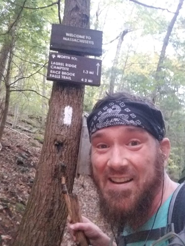
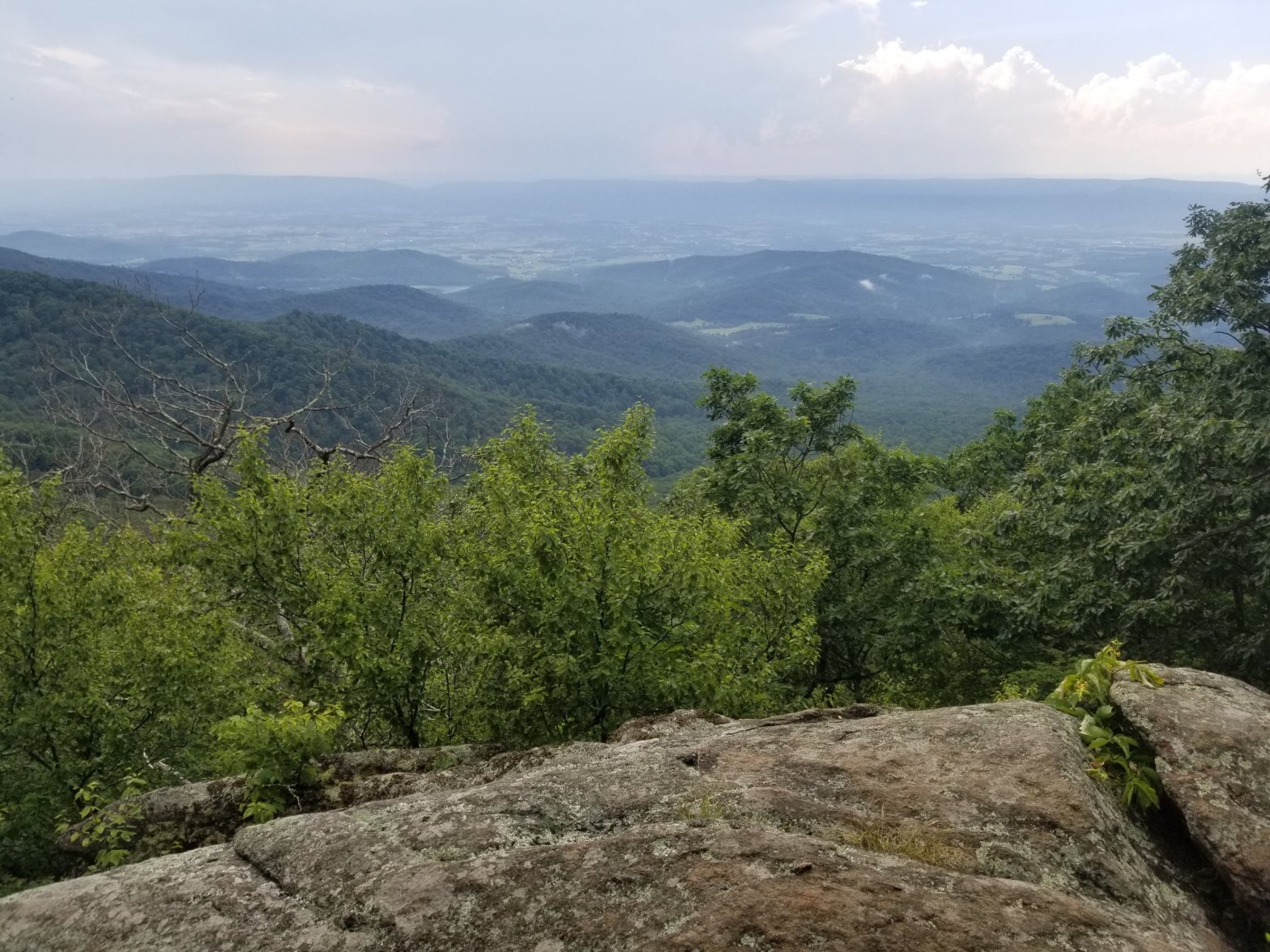
It got hot. And then it got hotter. And then it was hotter than hot. And the mosquitos started to feast. And it started becoming a little less than fun. I was thankful for the shade the trees provided. I reached the top of Pass Mountain and started my descent into Thornton Gap, lamenting the fact that each step down into the gap meant more climbing to get out of the gap. I crossed Highway 211 near Luray and started the climb that I had not been looking forward to. The climb was rocky and exposed. My precious shade was gone. After about an hour of climbing I stopped and took my pack off and leaned against the rock wall and thought I might doze off. I was exhausted and I knew I wasn’t even halfway up. I could hear thunder and saw dark clouds in the distance. I actually looked forward to the rain. I put my pack cover on and continued upwards, reaching Mary’s Rock about an hour later, just as the rewarding view at 3,500 feet disappeared completely and the downpour started. I took another break at an unnamed overlook and debated how much further I should go. Thankfully I had cell service and after consulting the wisdom of Jackpot I decided the Byrd’s Nest #3 would be my end point for the day… until I reached the shelter and decided I felt good enough and had enough daylight left to make it a bit further. Big mistake…

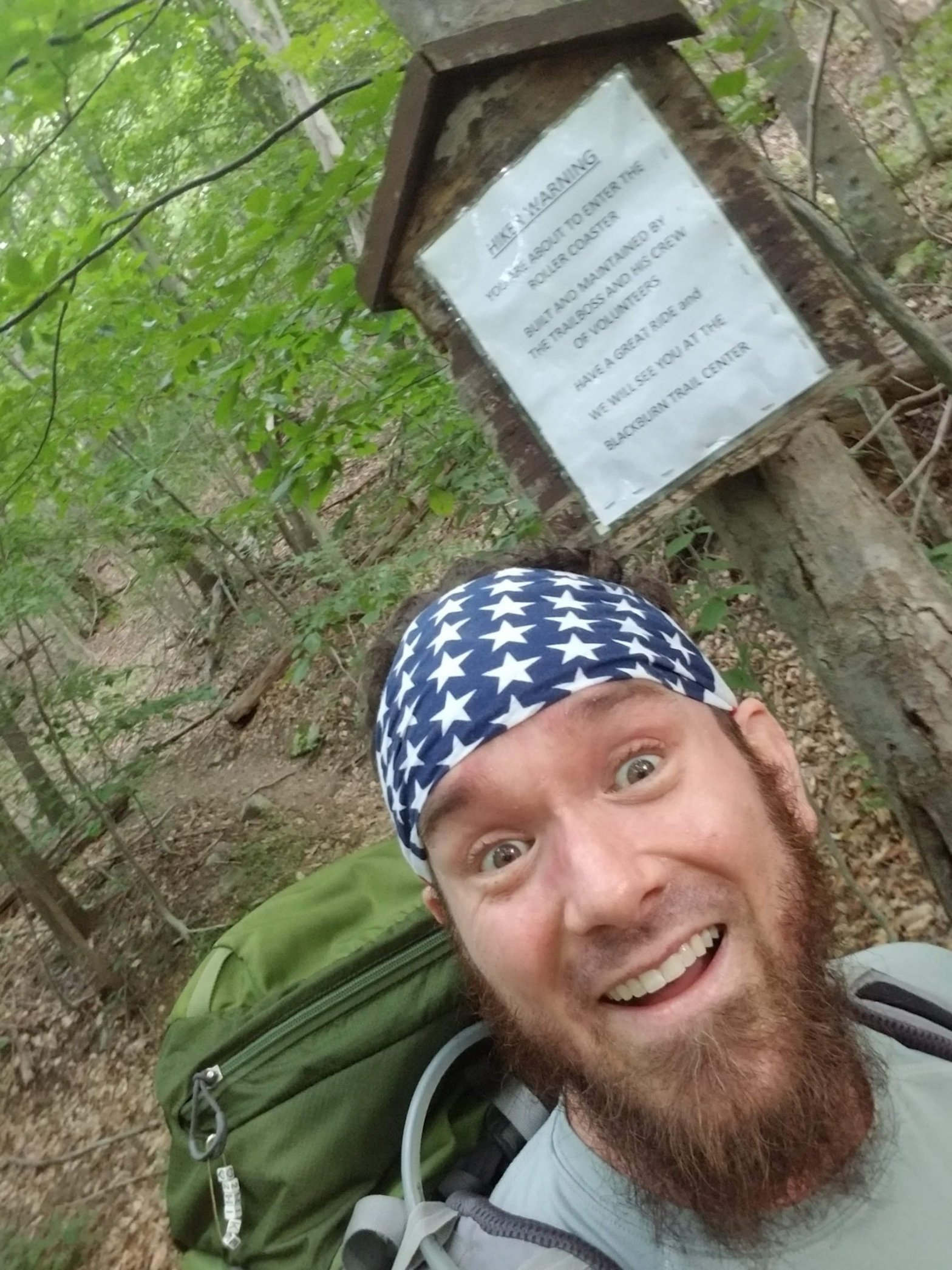
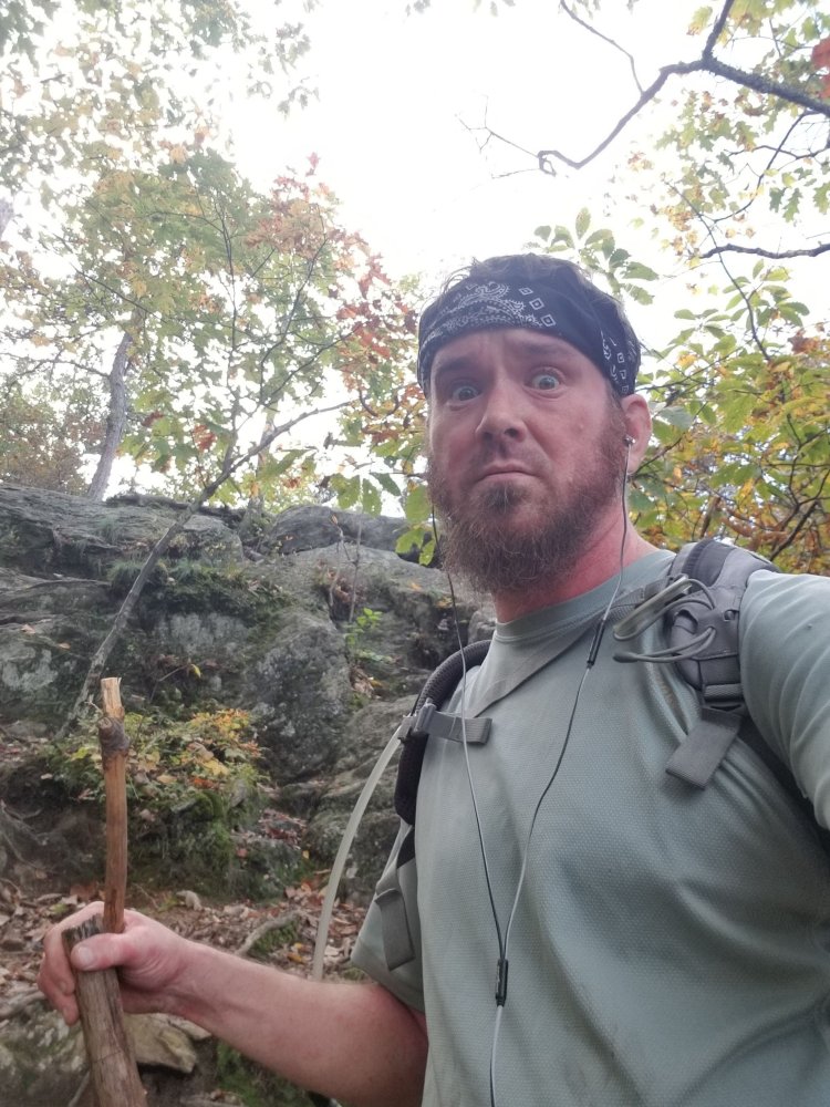
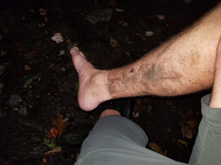
I decide to press on and climb The Pinnacle… it was only a 500 foot climb and seemed like a good idea at the time. After reaching the top and heading down the other side the familiar symptoms I’d experienced last year on the Roller Coaster started to surface. Dizziness, nausea, muscle cramping… “Here we go again” I thought… as the nausea progressed to vomiting. It was frustrating because I’d been doing a great job staying hydrated all day. It wasn’t dehydration. It was just exhaustion from overexertion… same as before. I need to do a better job of listening to my body and I should probably carry sports drinks in the future in addition to water. The muscle cramp in my calf was excruciating, but it makes for a great video.

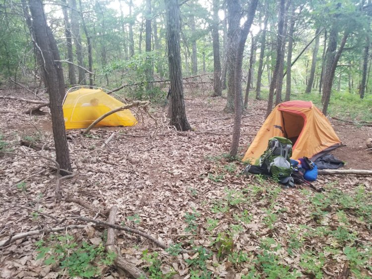
So… having had luck the previous night camping at the picnic area I decided to press on to the Pinnacles Picnic Area, which was two miles further than the endpoint I had decided on. It was a rough two miles, I stopped drinking more than a few sips of water at a time due to the vomiting. It was Sunday on the 4th of July weekend and the picnic area was packed. Several people took notice of me and offered me food, including a family that was grilling some indian food that smelled AMAZING but I had to decline it all because I didn’t think that watching me vomit their delicious meal would make for a great ending to their picnic. I roamed around for about an hour, trying not to look too creepy while I sized up the camping situation. It was a very large picnic area. I was able to refill my water there, and there was a National Park Service bear trap on a trailer that I wondered how often was put to use. I waited until the last picknickers were gone to hang my food and begin setting up my tent. The indian family had several small children who were quite enthralled with me to the point that the youngest toddler was resisting getting in the car to leave because he was enjoying our exchange of jibberish and peculiar facial expressions. It was very amusing and I did my best not to look like a homeless kidnapper. I think the family was pleased that I was able to occupy the kids while they packed up their minivan.

I set up my tent along the perimeter of the picnic area, against the tree line. I was as far away from any object or structure as I possibly could’ve been. I got as far away from the parking lot as I could, which was a few dozen yards. I’d learned earlier in the morning from Fresh Grounds that the park rangers are pretty strict about enforcing the backcountry camping rules, as well as the car camping rules. He has apparently received some negative attention for sleeping in his van, which I of course think is dumb but rules are rules. I fell asleep a bit nervous but my exhaustion was greater than my anxiety. Until 10:30….

My eyes opened to a flashlight shining through the 100 micron thick walls of my tent. It flickered on and off and then the voice…”POLICE…I need to you to come out of your tent!”

“Ok, let me put my shorts on.” The light was now shining like the three octillion candles of the sun. I crawled out of my one person tent (that’s basically an over-sized coffin) to be greeted with hostility by a park ranger who appeared to be getting great pleasure out of blinding me by shining his 4,000 lumen lazer beam directly into my eyes. “Anyone else in the tent with you?” he snarked. I resisted the urge to smirk. The first response that came to mind was, “Yeah, its a VW clown tent. I’ve got fifteen other hikers in there with me. Let me go wake them up.” But I wasn’t brave enough to get mouthy with this guy and I just wanted to go back to sleep, so I went with my second option, which was “no”.

He told me to have a seat at the nearby picnic table, and didn’t respond well when I reached down to massage the cramp in my leg. “Keep you hands where I can see them!” So at this point I’m thinking maybe there’s serial killer on the loose who’s sleeping in a tent matching the same description as mine. After my momentary blindness resolved I noticed another officer standing about fifteen yards to the left of Officer #1. Officer #2 acknowledged my recognition of him by lowering his hand to rest on his holstered service weapon. I looked around to see if there was an Officer #3 and wondered when the tanks and chopper would arrive. Clearly I was missing something, and these guys were preparing to make the biggest bust in the history of Shenandoah. Officer #1 asked if I had ID. I told him it was in the tent. I asked if he wanted to see my camping permit. He asked for my name and date of birth and had a very lengthy conversation on his radio. He then asked me to spell my name and had another radio conversation. He asked my date of birth again and I think he also asked for my SSN. He asked me if I had a vehicle, where I started hiking, how I got there, where my destination was, my street address, my occupation…I sat there for about fifteen minutes and the more the interrogation continued the more convinced I was that I was going to prison for life for camping in a picnic area. I felt like Arlo Guthrie, being accused of littering and treated like a terrorist.

While Officer #1 was relaying my life’s history into his radio, Officer #2 decided it was his turn with me now… After telling them I was an ER nurse I suppose he decided to try to call my bluff… asking me my thoughts on how the cytokine storm relates to COVID, and a few other nonsensical tests. I guess I passed the test, because Officer #1 took over again and asked if I knew that camping in a picnic area was illegal. I acknowledged that I knew it was but that I hadn’t felt safe hiking on a 3,500 foot ridge in the darkness while trying to find a campsite after vomiting all evening. He appeared to care very little, because he demanded that I pack up and leave the picnic area. He did not, however, issue me a citation… which at that point I would’ve gladly preferred if it had meant I got to stay put.

I put on my headlamp and packed up my gear and headed off into the darkness. The place I threw my tent down was rocky and uneven and I barely slept. At least I had a great breakfast!!

Leapfrog Cafe
Survived the thunderstorm
This muscle spasm video might need a disclaimer

Appalachian Trail Day 48

Gravel Springs Gap to Elkwallow Wayside – 5.9 miles

July 4th, 2020

It’s been almost six months since my last outing. I planned on writing about this hike as soon as I returned from it but its been a busy summer and I’m writing it six weeks later. Perhaps if I’m honest with myself the “busy summer” excuse isn’t as truthful as the “this hike was really disappointing and i just didn’t want to write about it” excuse.

I sent an email to Scott and Lisa who had hosted me in January and asked them for shuttle recommendations. They gave me the number of a girl named Allison who hosts hikers in Luray and also provides transportation. My plan was to leave my car at Swift Run Gap and have her drop me off at Gravel Springs Gap so I could pick up where I’d left off in January. I’d then hike the 50ish miles back to my car and decide if I wanted to go any further or not. I was hoping to finish the length of the park but also wanted to play it safe because I no longer think I’m a rock star. It felt like a reasonable plan and it ensured that I wouldn’t be biting off more than I could chew. I had strong reservations about hiking during one of the hottest weeks of the year, but being that my plans to hike in April had been squashed by the pandemic, I was chomping at the bit to get some miles in. Spring and fall are my preferred backpacking seasons. If ever I had any doubts about how miserable backpacking in July is for me, they have certainly been put to rest!

The first stop on my drive to VA was Ebright Azimuth, the highest point in Delaware. At 447 feet above sea level, it was less than climactic but bagging high points is another new hobby of mine and I had to start somewhere.

About halfway into my drive I got a call from Allison who was supposed to be my shuttle. She said her van broke down and she wouldn’t be able to help me out but she’d made arrangements to have someone else meet me in the same location we had arranged. I was very grateful.

I entered Shenandoah National Park at Swift Run Gap, purchased the National Park Pass (as I had plans to use it elsewhere throughout the summer) and got my backcountry camping permit. The wait in line to get into the park wasn’t as bad as I thought it would be. I was scheduled to meet my ride at 3pm and I made it on time. He was a few minutes late but I was just grateful that he showed up. He leapt out of his car to greet me and informed me that we had to pick up two other hikers on our way north. I wasn’t thrilled about this but I didn’t have a choice and still I was just grateful to have a ride. He’d probably booked them first and I was probably a late addition that he was doing as a favor for his friend Allison. We drove to Big Meadows Campground to meet the other two passengers, who I learned was a couple completing a southbound hike that they’d started in Harper’s Ferry. Lack of cell service made locating them a bit of an issue, but the fact that they’d had time to shower at the campground before getting in the car more than made up for any frustration at the further delay. I was eager to get started but I wasn’t going to complain. These issues were nobody’s fault. I chatted with our driver, who’s name I forget, and my fellow passengers, who lived in D.C. and were heading back there with our unnamed driver as soon as they dropped me off. They were friendly as we swapped stories and information. I forget their names, but I remember the female half of the pair was Vietnamese, and she’d hiked 18 miles on the PCT with a broken leg which I thought was pretty impressive. My opinion of her quickly changed when she shared her thoughts on the ease which she pranced through the Roller Coaster, which nearly did me in last year on Day 44.

I FINALLY started my hike at Gravel Springs Gap around 5pm…only about an hour later than I’d planned. I was happy. I bounded into the woods with the lightest pack I’ve ever carried for a multi-day hike. I’d proudly gotten my base weight down to 17lbs by reverting back to my original tent that I had stopped using after a few years because it’s not free-standing and set-up had become annoying. I also ditched my stove for this hike and upgraded my water filtration to thru-hiker standards. I also decided to leave the first aid kit at home. If I had any significant injury I’d do what we do in the ER… rub some dirt on it…

Up and over Hogback Mountain I went… stopping to take in the view. Being that this was the 4th of July in a national park .. it was a bit crowded in spots, which I had expected. I encountered dozens of day hikers… the most memorable of which was a group of (probably) college girls who stopped me to inquire, “How much further does this trail go?” They were heading north so I responded truthfully….”About a thousand miles”. I knew this wasn’t the answer they were looking for but I couldn’t resist and the looks of confusion on their faces was worth it. I followed my first response with a more helpful one and they were grateful for my assistance.

I was hoping to get more than six miles in today but having started so late it just wasn’t going to happen and I wanted to get my camp set up before dark so I stopped at the Elkwallow Wayside, which consists of a large picnic area and a little gift shop/snack store that was closed by the time I got there around 730. I looked forward to getting something to eat in the morning when they opened. The Appalachian Trail in Shenandoah runs rather (sort of) parallel to skyline drive, so even though it seems like you’re hiking deep in the woods, you’re never more than a mile or so from the road and the trail crosses the road many times through the length of the park, so happening upon campgrounds and overlooks accessed by vehicle happens rather frequently. I knew that hikers weren’t allowed to camp here, but the next hiker shelter wasn’t for seven miles and I wasn’t confident I’d find a suitable site between here and there to “stealth camp”. So I wandered around the area and waited for the last of the picnickers to leave. I discovered bathrooms (locked) and an ice machine (locked) and a spigot with running water which made me happy because that meant I could drink as much water as I wanted to that night and I could refill in the morning. The only thing left to do was to find an inconspicuous area to pitch my tent. I roamed around a bit more and found a solitary picnic site surrounded by tall grass that I decided should be a safe place. It was flat, no rocks, and setup was easy. I was a little disappointed that I hadn’t been lucky enough to find a site where I could watch fireworks from, but these are the chances you take when you roll the dice and don’t plan specifically. It was hot and I wished I’d had a fan or an air-conditioned tent, but I still fell asleep with a smile on my face.

Apparently there was a waterfall or something that this guy hiked to with his dog and his dog decided he didn’t feel like hiking back.
Happy Independence Day!!

Appalachian Trail Day 47

Gravel Springs Gap to Compton Gap – 9.4 miles

January 3rd, 2020

After enjoying another wonderful breakfast with Scott and Lisa, Lisa and I drove to the end of the Chester Gap trail near the Terrapin Station Hostel to drop off my car. She then drove me back into the park to Gravel Springs Gap to start my hike. There was rain in the forecast for today but I wasn’t too bothered by it because I knew I would be finishing back at my car. The park was rather empty and I encountered only one other hiker the entire day. It was actually more like a half day because I was finished by 3pm, just after the rain started to fall. The views today were very enjoyable, and I’m excited to get deeper into the park as well as the rest of the state of Virginia.

I wandered around Front Royal after my hike, exploring the visitor’s center and collecting passport stamps at Mountain Trails and River and Peak outfitters before having a great dinner at PaveMint Smokin’ Taphouse. I drove home with a full belly and the satisfaction of knowing I’d be back in VA soon.

Marshall Mountain
Scott and Lisa Jenkins are excellent hosts!

Appalachian Trail Day 46

Manassas Gap to Compton Gap – 12.2 miles

January 2nd, 2020

I had been entertaining the idea of starting the year with a hike but it remained an idea until I spontaneously decided to put it into action on this particular day around 4pm. The forecast looked agreeable and although I didn’t have a place to stay or any transportation arranged once I arrived in Virginia, I decided that I’d be ok with once again winging it.

I explored my trail guide on the way to Virginia and reached out to Scott and Lisa Jenkins of the Mountain Home Cabin which said it was open year round😀. I made a phone call and explained what I was hoping to do and Scott said he was able and willing to accommodate me. Scott is an AT thru-hiker (2012) and he and his wife operate a Bed and Breakfast 100 yards from the trail and also host hikers in a cabin on their property. In the morning they served me an amazing breakfast and sat and chatted with me for a while and then Scott drove me to Manassas Gap so I could pick up where Jeff and I had left off almost 8 months ago. Someone had left trail magic cookies on the picnic table at the parking area and Scott snatched them up and handed them to me, then indicated he was going to stick around and scan the area for trash. He’s really an asset to the AT community and it was a privilege to be his guest. I was very excited to be back in Virginia and this close to starting the SNP section of the trail. The plan was to hike from Manassas Gap back to Scott’s place, which I apparently gave myself more than enough time to do, and I realized after a few hours that I was going to arrive back at the cabin with more daylight left than I’d anticipated. I think I conservatively estimated my miles because the memory of the Roller Coaster was still fresh in my mind and the last thing I wanted to do was once again bite off more than I could chew. I was also keenly aware that my daylight hours were significantly reduced. My hike was basically a thousand foot climb and then descent, over roughly 8 miles. Around noon I called and spoke to Lisa and indicated I’d be arriving back at the cabin before 2pm. I asked if she or Scott would be willing to drive me a few miles south so I could hike back to cabin from the other direction and get more miles in, and of course she said yes. Scott drove me to Compton Gap in Shenandoah National Park and I hiked north this time heading down hill 1,500ft over 5.6 miles back to the cabin. I arrived back at the cabin just before dark, met my fellow guest that night who was a hiker named Rebecca (I think) from the Pittsburgh area, showered, and headed out to explore the town of Front Royal. First stop was the Virginia Beer Museum, followed by dinner at the Front Royal Brewing Company. Front Royal is a sleepy little trail town that goes to bed early, so that’s what I did. The nice part about this hike is that I was able to leave my 70L pack at home 😀… with my tent and sleeping bag!

Best hiker breakfast EVER!

Appalachian Trail Day 45

Bolden Hollow to Manassas Gap – 16.3 miles

Sunday, June 16th 2019

I awoke today having slept for almost twelve hours and feeling much better. Knowing that the Roller Coaster would be behind us in a few minutes was quite a relief! I had survived! This was still a difficult day for me and the idea of actually not finishing today and splitting the next 16 miles up over two day was discussed, but ultimately we decided to muscle through. We paused briefly at the southern end of the Roller Coaster to celebrate and then continued on to Rod Hollow Shelter to stop for breakfast. The miles today weren’t “easy” but they were definitely not as challenging as those of the previous day. We crossed Ashby Gap and and climbed 900ft over 2.5 miles to the top of Sky Meadows State Park where we encountered many groups of day hikers. I was still very tired but I tried to keep my complaints to a minimum. We arrived Dicks Dome Shelter with 7 miles to go and mentioned the idea of stopping there for the night but we decided against it. It didn’t appear the rest of the miles would be too difficult. We reached the intersection of Tico Tower Trail, which at 2102ft was the highest point on our hike, and still there were no views to appreciate. I felt a bit disappointed that Jeff’s first outing with me was not more representative of the spectacular views more common on other sections of the trail. From here it was just about 1400ft down over the course of 4.5 miles to our end point. We passed Manassas Gap Shelter and this was the last I saw of Jeff until I arrived back at the car to find him waiting patiently for me. I felt pretty bad for not living up to my expectations for this hike. I’d done a lot of whining and I give him a lot of credit for putting up with me. I know we’ll hike together again soon and I’m looking forward to redeeming myself!

Breakfast at Rod Hollow Shelter
The look of a weary hiker disappointed in himself.

Appalachian Trail Day 44

Stream Campsite to Bolden Hollow – 10.2 miles

Saturday, June 15th 2019

So today was my turn to be the goat… that’s what I get for picking on my buddy! I was up around 6:30… we took our time packing up and started walking around 8:00, crossing Snickers Gap and arriving at the Bears Den Hostel around 9:00. We took a little tour of the lovely accommodations that we’d missed out on the night before and I got my passport stamped. The caretaker was friendly and we shared a brief chat with an older female hiker and her little dog. I purchased a Mountain Dew, took too many photos, charged my phone a bit and we were on our way again. Up, down, up, down, up down… we stopped to eat and refill our water at the stream between Sam Moore Shelter and Buzzard Hill, near the thousand mile mark for northbound thru-hikers. There was a little commemoration there where someone had formed the numbers “1 0 0 0” with rocks. Being the weekend, there were more than a few day hikers out and about, and we found ourselves briefly hiking in a parade of small children. One of their parents kindly took a photo of Jeff and I at the top of Buzzard Hill… one of the few places on the Roller Coaster that had even the slightest semblance of a view, albeit still rather disappointing. I’d been managing to maintain a pretty decent pace up until this point, with Jeff and I regularly exchanging the lead position, (He often overtook me on the climbs.) but somewhere around the Morgan Mill Stream, with three miles left to go on the hellacious Roller Coaster, I really started to fall apart. Perhaps I hadn’t been drinking enough water, or perhaps I hadn’t eaten enough, or perhaps I was just no match for these mountains… but things started to deteriorate quickly for me. I was pausing to rest several times each minute while Jeff seemed to actually be gaining momentum! His body was churning up and down these hills like a machine. It was really impressive. By the time we started the climb out of Bolden Hollow it became obvious to me that I wasn’t going to make it much further. I was nauseous, dizzy, and my vision started to blur. I felt like I was going to collapse. I couldn’t keep my eyes open. I’d never felt like this in my life. My exhaustion was real and each step felt like it was going to be my last. (Sorry if this sounds so dramatic.) I began to seriously ponder myself having to be rescued. I felt embarrassed… what if Jeff eventually wandered back to find me laying unconscious? I tried to call him on the phone but no signal… I tried to yell his name but seriously couldn’t muster much more than a squeak. What was happening to me? I’d done tougher sections than this before, hadn’t I? Was the trail punishing me for picking on Jeff last night? I became more dizzy and a few times I leaned over on my poles and had to fight to keep my eyes open. I reached the top of the last peak… just over half a mile before the end of this infernal Roller Coaster, and my body said it was done. I was now able to reach Jeff on the phone, who probably by now had the end of the Roller Coaster in sight, and informed him of my situation. He immediately turned around and was at my side in just a few minutes. I don’t even think the guy was sweating! I dumped my pack in a decent clearing and immediately started vomiting. I had my tent set up in about ninety seconds and I crawled inside, closed my eyes, and waited for the grim reaper to arrive. Fortunately, he never showed up. It was somewhere around 7:30pm, I’m guessing. I felt bad leaving Jeff to fend for himself but I knew he understood. I was toast.

6:30am
Last night’s camp. Wasn’t the best site but we made it work!
Filtered coffee… Jeff’s luxury item!
Snickers Gap
Inside the Bear’s Den
Bear’s Den Rocks
I didn’t die!

Appalachian Trail Day 43

Keys Gap WV to Stream campsite – 12.8 miles

Friday, June 14th 2019

Southbound: This hike was eagerly anticipated for two reasons… I was finally hiking the infamous Roller Coaster section of the trail in Virginia… and I was thrilled to be doing it with my good friend Jeff Myers. This was to be Jeff’s first experience with the AT and I knew he was going to love it! (Little did I know that on the following day I was going to HATE it!) Jeff and I drove to Manassas Gap and parked my car there at our end point and drove back to Keys Gap in his car. We started our hike around 1:30 in Keys Gap, where there were some generous trail angels offering meals to hikers. We made quick work of the first few miles. Saw a girl in a dress hiking barefoot. That was definitely a first. Stopped at the Blackburn AT Center and got my passport stamped 🤪 and took some photos. (The Blackburn Center had been the target endpoint for Rock Turtle and I nineteen months ago but came up 6.2 miles short.)

4.3 miles later we were at the north end of the Roller Coaster fastening our seat belts. I’m not gonna lie…I was a little intimidated but I thought, “How bad could it be?” We made it 2.5 more miles and started thinking about shelter for the night. The Bear’s Den Hostel was our goal for the night, but my Guthook app said to call for reservations, and being a Friday, I thought that would be a good idea. I called and they told me they were full and that they didn’t even have room for us to camp, which I thought was weird but I wasn’t going to argue. Maybe the don’t allow tenting? Unfortunately, that left us to scramble for an adequate stealth site on which to throw our tents for the night. We sized up a few locations and settled on a subpar area that was probably one of the worst places I’ve ever camped but we were out of options and daylight was fading. At least it was near a water source. Now the fun begins…

We dropped our packs, unloaded our gear, filtered some water from the nearby stream, and I went to work setting my tent up. I glanced up as I was finishing and noticed Jeff appeared to be struggling a bit. Actually he was struggling a lot. And then the unthinkable occurred to me but I was in such disbelief that I couldn’t get the words out…I might’ve actually suffered a small stroke, to be honest. “Jeff, please tell me this isn’t your first time setting this tent up.” I knew all his gear was brand new because we’d had a little shakedown session the night before and I’d gotten to swoon over all his shiny brand new stuff but NEVER did it cross my mind that this brilliant young man would embark on a back country hiking expedition having NEVER taken his tent out of the bag! I was unable to hide my disbelief. I didn’t know whether to fall down laughing or to sob hysterically. I settled for mournful weeping. Actually I had time to do neither because it was getting dark and I honestly felt bad for the guy. “ARE YOU FREAKING KIDDING ME?!” were the only appropriate words I could seem to find. I wasn’t familiar with his particular tent and it was actually a bit confusing but we managed to get it figured out at least somewhat correctly. I went back to my tent to start cooking dinner and then the next round of shenanigans began… “Aw man… there’s a bug!” (“Yes Jeff, that’s correct. You ARE in the woods…”) “There’s another one! They’re in my tent! They’re everywhere!” and I proceeded to rescue Jeff from the throes of his arachnid assault that would have most certainly led to his untimely death. I felt bad for not having prepped him that there might be insects in the woods. Lesson learned! After the extermination we retired to our tents and then it was time for Act 3… “Did you hear that…?” (“Did I hear what?”) “That noise… ” (“Yes Jeff, it’s a bear. Go to sleep!”) “Shut up! That’s not funny man!” …. as I giggled like an evil little kid. I’d forgotten what it was like to sleep on the trail for the first time and I didn’t mind a little ribbing at Jeff’s expense. I knew he could handle it. Honestly Jeff would be the one to have the last laugh, as I would finish my day tomorrow with the trail definitely having gotten the best of me. I love him like a brother and having him hike with me was a total thrill-enhancer. I can’t wait to do it with him again. Hopefully spring of 2020!

Stepping off from Keys Gap
Blackburn AT Center
Got another stamp!
North end of the Roller Coaster
The face says it all…
Raven Rocks

Appalachian Trail Day 42

Laurel Ridge Campsite to Shay’s Rebellion Monument – 11.1 miles

Wednesday, October 10th 2018

Well… today will break yesterday’s record of highest elevation on the trail so far… I’ve got Mt. Everett to look forward to! 2602 feet! My legs were not sharing my excitement and instead were asking if it was time to go home yet. I politely told them to shut up. I was really struggling with these mountains. The climbs were taking forever but the descents were even worse! The views though… were really something. I felt very satisfied with what I was accomplishing and knew I only had 11 miles to go today. The day started immediately with a climb up Mt. Race… which was a 700 foot climb over two miles up to 2365 feet… not terrible. Then down again and repeat… this time up 700 more feet over just 0.7 miles to Mt. Everett. This was a tough one… but I took my time. It was mostly rocks and they were very slippery. At the top there was a nice guy there with his dogs who was kind enough to take my photo. I didn’t pause as long as I should have to take in the views because my blood was really pumping and I was just so anxious to bang out the rest of these miles… and I was a bit nervous about the descents…my knees were really starting to protest. Down, down, down… almost 2000 feet to MA 41… I was in such pain when I reached the bottom and so rattled by so many close calls with missteps on the slippery rocks that almost sent me over the edge that I made the decision to ditch my pack behind a tree along the edge of the road and hike the next two miles to my car and then drive back and retrieve my pack. I was EXHAUSTED. About halfway down when I was REALLY missing my poles I grabbed two sticks and started using them almost like crutches to support my weight while I descended. Either my physical condition had really deteriorated lately or this Taconic Range was really a killer! Anyway… I made it Shay’s Rebellion Monument and poetically re-enacted a rebellion of my own! I had been victorious!

Laurel Ridge Campsite
Climbing Mt. Race before breakfast.
One of the descents that I fell on. Super slippery! Hard to tell how steep it is in the photo

NOT having fun right now! But at least I have a new walking stick!

This whole hike was a rebellion!

Appalachian Trail Day 41

Housatonic River Road to Laurel Ridge Campsite – 15.3 miles

Tuesday, October 9th 2018

Finally finishing Connecticut! Big Lu picked me up bright and early at the Shay’s Rebellion Monument and delivered me back to Housatonic River Road to start my hike. I enjoyed talking to her and learned quite a bit. As we approached the drop-off, she inquired about how I was planning on getting back to my vehicle the following night. I was a bit confused by her inquiry because I thought it was quite obvious that I was hiking there. Her response was something like… “Tomorrow night? Honey you’ve got the whole Taconic Mountain Range to cross!” And before I could respond she sped away, leaving me standing there wondering where I could have possibly miscalculated. I’m usually extremely accurate at estimating the distances I’ll cover, (and usually quite conservative) so I was perplexed and honestly more than a bit worried because clearly she knew these mountains better than I did! What had I done? How long would it take me? How had i bitten off more than I could chew? Had I really underestimated these mountains? Was I going to die out here of starvation? Would they ever find my body? “Pull yourself together dude! You’ve got this!” I said to myself. “Challenge accepted!” I decided… and it became my mission to prove to Big Lu that I could in fact finish Connecticut, cross the Taconic Range and be thirteen miles into Massachusetts by tomorrow night. And then I realized I’d forgotten my poles….😰

And so it was that the “Hike of Misfortune – A Fool’s Journey” began… I started the 900 foot climb up my first peak of the day… Mt. Prospect… and then back down the other side. A few hours later I was at Riga Shelter, followed by Bear Mountain… the highest point in Connecticut and my highest elevation on the trail to date. It’s only 2300′ but it felt like Everest! Fortunately the skies were clear. The views were spectacular! After a pretty uneasy descent, I arrived at Sage’s Ravine and crossed happily into Massachusetts. Six states complete! I was praying that MA would offer me some mercy but that wasn’t happening. I limped into Laurel Ridge Campsite by moonlight and wondered why I hadn’t hired someone to come set up my tent for me. That reminds me… new tent this trip! Free-standing! So far so good!

Housatonic Falls
The look on my face after hearing Big Lu’s words…
Beginning to see what Big Lu was talking about…
Determination!! Survived the thousand foot climb to Riga Shelter. 700 more feet to the top of Bear Mountain!
Maybe it’s not so bad after all…
Bear Mountain rock observation tower
Top of Bear Mountain
I think I decided the safest way down was to sit and slide.
Descending slippery wet rocks… what could go wrong?😜
The state line!
The most jubilance I could muster!
Got a little muddy today but I’m still in one piece!

Appalachian Trail Day 40

US 7, CT 112 to Housatonic River Road – 3.1 miles

Monday, October 8th 2018

Back in Connecticut heading north this time! It’s been 2.5 years but it’s finally time to finish Connecticut! I once again feel like a broken record by saying it but this was once again a much more difficult hike than I’d anticipated. And not only because I’d forgotten my poles…

I drove to CT without a plan and decided I’d figure things out when I got there. This is often the way I function as spontaneity is sort of a way of life for me and especially when I’m solo it doesn’t really matter because if things don’t work out no one else is affected by the consequences! It was late afternoon by the time I arrived and I found the nearest parking lot to where I had left off in 2016. It was the on Water Street just west of Falls Village. I sat in the car and pondered my options and as luck would have it, a friendly old guy from PA happened to be sitting in his truck next to me. I chatted with him and he said he was a shuttle driver, waiting to pick up some lady hikers but apparently they were running behind schedule. I asked him if he’d mind driving me a few miles down the road to CT 112/US 7 and he was kind enough to agree. Great! At least I’d get a few miles in before dark! He dropped me off and I hiked an easy 2.5 miles back to my car. Ok…now what to do next? I had no other options for transportation yet. I hiked 0.6 miles to Housatonic River Road to check out the waterfalls I’d read about and walked back to my car along the road. It was now dark. Time to make some decisions…

Why is it that nice scenery and poor cell service always seem to go hand in hand? Western Connecticut is very beautiful but the cell service sucks. I drove 19 miles to Great Barrington, MA and hoped for better luck. There wasn’t an Uber or Lyft to be found… so I instead decided to try to find a shuttle that would take me back to Falls Village in the morning. I sent a few emails and texts to addresses I found on whiteblaze.net and hoped for the best. In the meantime… I was in a new town and had some exploring to do! I enjoyed a great meal at the Barrington Brewery which is apparently the first solar powered brewery on the east coast. While I was eating I heard back from one of the people I had contacted… a little woman named Big Lu who runs the Bearded Woods Bunk & Dine with her husband, Hudson. We arranged for her to meet me in the morning at the parking lot at Shay’s Rebellion Monument on Sheffield Egremont Road and shuttle me back to Housatonic River Road where I’d ended my short hike today. I felt pretty good about having been successful throwing all this together at the last minute. Now… to find somewhere to sleep! I opted for car camping and after scouting a few locations I ended up in the parking lot of a local motel and called it a night. There’s no hotel quite like a Subaru Outback!